
Project Name:Tectonics of the Western Caribbean
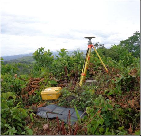
Operating and expanding the current GPS network in Panama provides a valuable data set to investigate the interaction of the Caribbean, Cocos, Nazca, and South American plates in the Panama Region (PR). Although this region was previously modeled and interpreted as a single tectonic block, we hypothesize that major fault systems cross the PR breaking it into small blocks that must be accounted for in a new tectonic model of the region. To improve the spatial and temporal extent of the deformation field in Panama, scientists from PSU and IGC made observations at 12 sites and installed a new site in western Panama, HORN station (Fig. 1 and 2) during May 2014. The GPS data are analyzed using GYPSI-OASIS II software in the PSU Volcanology and Tectonics Lab. To increase the number of observations and to test our hypothesis, we have planned to expand the episodic site network, as well make new observations at existing GPS sites in January 2015.

Figure 1. Episodic GPS station –CRUZ- located in western Panama. Each station was running at least 48 hours. Photo. Gorki Ruiz-PSU.
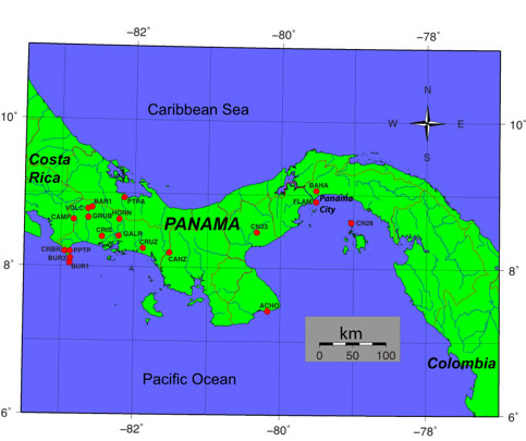
Figure 2. Current GPS network, episodic and continuum stations re-measured in May 2014. The station HORN was set during this campaign.
